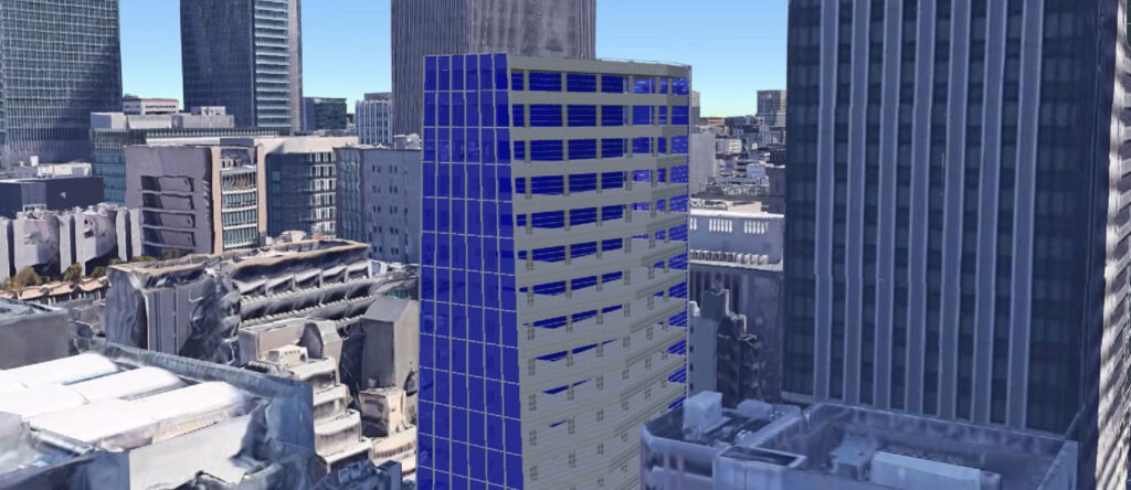
A practical Rhino × GIS workflow for publishing georeferenced 3D models through Cesium ion. By preserving geographic context from design to web-based visualisation, this project demonstrates how Rhino, GIS, and Cesium work together to support spatial workflows and digital twin applications.
Overview
This project demonstrates a practical workflow for connecting Rhino, GIS, and Cesium while maintaining geographic context across the workflow.
Rather than using Cesium simply as a visualisation platform, the workflow preserves geographic context throughout the design process. Rhino is used for modelling, GIS provides real-world geographic position, and Cesium places the georeferenced model within a broader geospatial context for web-based visualisation and sharing.
The workflow supports georeferenced design, web-based visualisation, digital twin applications, and location-aware spatial workflows.
Objectives
The objectives of this project are to:
- Integrate Rhino models with real-world geographic coordinates.
- Preserve Coordinate Reference Systems (CRS) throughout the workflow.
- Visualise and share georeferenced 3D models using Cesium ion.
- Connect design workflows with GIS-based spatial context.
- Demonstrate practical workflows for digital twin applications and spatial decision-making.
Workflow Summary
The workflow consists of five main steps:
- Import GIS data into Rhino using Heron.
- Define the appropriate Coordinate Reference System (CRS).
- Create or position Rhino models within a real-world coordinate system.
- Export and publish the models through Cesium ion.
- Share and explore the models in a web-based geospatial environment.
Rather than focusing on individual software features, this workflow demonstrates how geographic context can be maintained as a model moves from design to web-based geospatial visualisation.
Key Technologies
- Rhino
- Grasshopper
- Heron
- GIS
- Coordinate Reference Systems (CRS)
- WGS84 / EPSG:4326
- KMZ
- Cesium ion
Key Outcomes
This workflow enables:
- Accurate georeferenced Rhino models.
- Georeferenced 3D visualisation.
- Web-based 3D model sharing.
- Integration between design and GIS workflows.
- A practical foundation for digital twin applications.
Position within My Work
This project represents one practical implementation of my Rhino × GIS approach, demonstrating how geometric form and geographic position can be extended into a broader geospatial context through Cesium.
It also forms part of the Rhino × GIS × AI Framework, where:
Rhino gives form.
GIS gives position.
AI gives inference.
More broadly, it reflects the principle of Spatial Intelligence Assemblage, which explores how new forms of spatial intelligence emerge through the relationships between architecture, GIS, and artificial intelligence.
Further Reading
Detailed step-by-step tutorials are available on the AppliCraft website (Japanese).
Rhino × GIS Integration: Getting Started with Heron
Learn how to import GIS data into Rhino, define Coordinate Reference Systems, and prepare georeferenced models for downstream workflows.
→ https://www.applicraft.com/tips/rhinoceros/rhinogis4/
Rhino × GIS Integration: Sharing Rhino Models with Cesium ion
Learn how to publish georeferenced Rhino models through Cesium ion while preserving their geographic location for web-based visualisation and sharing.
→ https://www.applicraft.com/tips/rhinoceros/rhinogis5/
Related
Rhino × GIS × AI Framework
Explore how Rhino, GIS, and AI work together to support spatial understanding and decision-making.
Spatial Intelligence Assemblage
Learn more about the broader principle behind this workflow and how new forms of spatial intelligence emerge through the relationships between disciplines.